In a nutshell
- Every single year Vestfjorden claims its victims, and in this respect it can be compared to a great burial ground where thousands upon thousands have found their grave. [1]
- The same book notes that in good weather Vestfjorden has quite another face, and the great surface can lie calm and shining as a mirror. [1]
- The 1908 county survey records that the boat post was wrecked in Vestfjorden on 3 December 1803, and again in 1822 and in 1824. [4]
- A 1926 travel handbook records that at Sørvågen the first wireless station was set up in 1906, the second in the world. [7]
The gap in the wall
Lofoten is a wall. On the drive from Svolvær the mountains stand up on one side of the road all day, and on the other there is an opening of grey water so wide that in poor visibility you cannot see across it. That is Vestfjorden, and it is not really a fjord at all: it is the arm of sea that separates the islands from the Norwegian mainland.
It was also the road. Every fisherman coming to the Lofoten winter fishery from the mainland had to cross it, in an open boat, in January.
A book of 1899 gives it the sentence that is hard to improve on. Every single year Vestfjorden claims its victims, it says, and in this respect it can be compared to a great burial ground, where thousands upon thousands have found their grave. [1]
The same writer is careful to record the other face. In good weather Vestfjorden has quite another physiognomy to show, and the great surface can lie calm and shining as a mirror. [1] Both sentences are true, and the difference between them is a few hours of weather.
What happened when the weather turned
A collection of northern sketches published in 1888 describes the moment: at about three in the afternoon the sky broke apart, and the hurricane rolled suddenly down Vestfjorden with a terrible crash and roar. [2]
The numbers, where anyone recorded them, are small and specific. Lofotposten reported in 1906 that in January and February 1718 five men were lost on Vestfjorden on the journey to Lofoten, and that the winter appears otherwise to have been very unsettled. [3] Five men, one crossing, more than two centuries ago, and still on the record.
The official post crossed too, and it did not always arrive. The 1908 county survey records that the boat post was wrecked in Vestfjorden on 3 December 1803, and was likewise wrecked in 1822 and in 1824. [4] Three times in twenty-one years, and this was the mail.
Steamers changed the odds but not the water. A note in Morgenbladet of 1876 explains that a particular passage is the way to Svolvær and the only reasonable one when there is a heavy sea in Vestfjorden, which is why the Christiania to Tromsø ships often take it. [5] Even the big ships were choosing their route around it. The county council heard in 1917 that experience of the war had shown that waters such as Folden, Vestfjorden and the large Finnmark fjords were not recognised as lying inside the territorial limit. [6] The fjord was open sea in law as well as in weather.
One curiosity from the same survey, because it says something about how far north this water really is. Vestfjorden is, according to von Buch, the northernmost place where oysters have been found, and none have been observed further north. [4]
A fishery run by telegram
The reason Vestfjorden mattered so much every winter is that tens of thousands of men crossed it for the cod, and the whole operation was administered as a single event with a start date and a chief.
The telegrams read like a naval despatch. In January 1871 the Interior Department received a wire from the chief of the inspectorate at the Lofoten fishery, dated Svolvær: the inspectorate came into operation today, the fishery has begun. [13] Two years later the same office wired, dated Svolvær: both yesterday and today there has been a southerly storm. [14]
The inspectorate ran from 16 January to 30 April, on the stretch from Brettesnes in Lofoten to Lofotodden. [4] Where it applied mattered enormously, because the Lofoten act applied only that far. Beyond Lofotodden the law simply stopped. [16]
That produced one of the more human arguments in the record. In 1911 the parish council of Røst stated as its firm opinion that Røst should not come under the Lofoten act. [15] Later, the same committee received an approach from 521 fishermen on Røst asking that Røst be placed under the act and the inspectorate. [15] The council said no and five hundred and twenty-one of its own fishermen said yes.
Værøy, next door, was straightforward: the mayor put the question to the fishermen and reported that Værøy wished to come under the Lofoten act. [15]

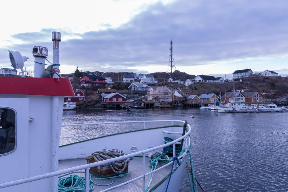
A fishing village on the outermost coast of Norway, and in 1906 the site of the first wireless station here and the second in the world.
The station at the end of the road
Now the fact that ought to be better known than it is.
A 1926 travel handbook, describing the run south along the Lofoten wall, notes that a little further south one reaches Sørvågen, where the first wireless station was set up in 1906, the second in the world. [7]
Sørvågen is a small fishing village a few kilometres short of Å. It is about as far from a capital city as it is possible to get in Norway, and it had wireless telegraphy in 1906.
The reason is the fishery. Røst and Værøy sit out beyond the Moskstraumen with no cable and no reliable boat in winter, and the entire economy of Lofoten depended on knowing where the cod was and what it was fetching. A telegraph that needs no wire is worth more at Sørvågen than in most European cities, and the state built it there first.
The system was still running decades later. Bodø Tidende reported in 1929 the transmitting wavelengths in use: 500 metres for Sørvågen, 600 metres for Røst and Hammerfest, and 510 metres for Vardø. [8] Sørvågen, Røst, Hammerfest, Vardø. Every one of them a place the ordinary post could not reach in winter.
The 1924 sailing directions place the village for a mariner: the first harbour is Sørvågen, and the lighthouse, a timber building, stands on the headland Glåpen, which shows clearly as one comes in under land. [9]
Wires, everywhere, all at once
The wireless was the spectacular end of a broader push to connect the islands, and the record shows how hard it was.
In 1898 Bergens Annonce Tidende reported that thirty men were still at work putting up a state telephone line from Svolvær to Ballstad. [12] Thirty men, one line, along a coast of cliffs.
An electrical journal of 1903 gives the cost and the politics in a single sentence: the telephone line from Svolvær to Ballstad cost about a hundred thousand kroner and was forced through ahead of a private application. [11]
It was used. A municipal journal of 1918 records that the Svolvær telegraph office sent and received 60,775 telegrams in the budget year 1911 to 1912. [10] For a fishing town, that is an extraordinary volume of traffic, and it is the clearest measure of what these islands were doing: buying, selling and reporting fish, in real time, from the Arctic.
Svolvær when the boats were out
The tour begins at Svolvær, so it is worth knowing what the place was when all this was happening.
A book of sea stories published in 1890 describes the daily emptying of it. When all the fishermen had gone out to sea, Svolvær was transformed into a deserted place, with only a few smacks lying here and there. [17]
In season it was the opposite. In July 1887 a newspaper reported that on the Saturday evening the ship passed Svolvær, where the Crown Prince and Princess went ashore and viewed the fishing station and a fully equipped fishing boat, with a large turnout of the Lofoten population and bouquets of flowers. [18]
A royal visit to look at a fishing boat is a fair summary of the town's standing. Svolvær was not a resort. It was the administrative centre of the largest seasonal fishery in Europe, and the boat was the thing worth showing.
What you see of it today
The water is on your left for most of the drive south and west, and it is the reason the light is the way it is: an open horizon that far north gives the long, low sun that every photograph of Lofoten depends on.
In clear weather you can see the mainland mountains across it, which puts the crossing in perspective better than any account. It looks close. It was not.
At Sørvågen the site of the wireless station is marked, and the village is a two-minute detour from the road on the way to Å. If you have a spare moment there, it is worth taking: from a small harbour on the outermost coast of Norway, in 1906, someone sent a message through the air.
Crossing it, and connecting it
1718: five men
In January and February five men are lost on Vestfjorden on the journey to Lofoten. [3]
1803, 1822, 1824: the post
The boat post is wrecked in Vestfjorden on 3 December 1803, and twice more within twenty-one years. [4]
1871: the inspectorate opens
A telegram from Svolvær tells the Interior Department that the inspectorate is in operation and the fishery has begun. [12]
1887: a royal visit
The Crown Prince and Princess go ashore at Svolvær to view the fishing station and a fully equipped boat. [17]
1898: thirty men on a line
A state telephone line from Svolvær to Ballstad is still being put up. [11]
1899: the burial ground
Vestfjorden claims its victims every year and is compared to a great burial ground. [1]
1906: the wireless
The first wireless station at Sørvågen is set up, the second in the world. [7]
1911: 521 fishermen
Røst's council says no to the Lofoten act; 521 of Røst's fishermen ask to come under it. [14]
1929: still transmitting
Sørvågen works on 500 metres, Røst and Hammerfest on 600, Vardø on 510. [8]
Drive the wall, see the water
from US$209Reserve now & pay later