In a nutshell
- Between Lofotodden, the south-westernmost point of Moskenesøy, and the island of Mosken, whose northern point lies eight kilometres south-south-west of it, according to the 1907 county survey. [1]
- The same survey records that the current is strongest between the skerries called Svarvarne and Lofotodden, and that it is worst in a south-easterly or north-westerly wind. [1]
- An 1897 description of the district notes that from a distance the current-seas outside Lofotodden look like holms and skerries, and that they came rolling not like ordinary waves, evenly rounded. [4]
- In 1912 a paper reported that the households at Helle and Refsvik, on the west side of Lofotodden, were often completely cut off from the outside world, because the currents made it impossible to get round. [10]
The most famous water in northern Norway
Å is the end of the road. The E10 runs the length of Lofoten and simply stops there, at a village whose name is a single letter, and the tour turns round. What lies beyond it is the reason anyone in Europe had heard of these islands before the photographs.
The 1907 county survey of Nordland puts it without decoration. Best known of all the currents in Nordland is the Moskenstraumen between Mosken and Lofotodden, it says, widely famous far beyond our country's borders. [1]
A 1910 book on Lofoten and the Lofoten fishery is blunter about why. The maelstrom in the sound between Lofotodden on Moskenesøy and Mosken has whirled dangerously round in mankind's imagination right from grey antiquity. [2]
That is the honest description of the fame. The current is real and it is powerful; the whirlpool that swallows ships is a literary invention, and Norwegian writers of the period were already a little tired of it. A 1903 travel book puts the eye-roll in one clause: famous, of course, is the Moskenstraumen between Lofotodden and Mosken, and it was another matter in the old days, when there was imagination and grandeur in the rumour-maker's art. [3]
What the surveyors actually measured
Strip the legend away and the technical descriptions are more interesting than the myth, because they were written by people who had to take boats through it.
The current lies between Mosken and Lofotodden, and it is strongest between the skerries called Svarvarne and Lofotodden. It is at its worst in a south-easterly or north-westerly wind. [1] Wind against tide is the condition every sailor fears, and here it is named precisely.
The tide drives it. At high water the current begins to set south-west from Lofotodden and out through the Moskenstraumen, and south-west past Værøy and Røst. [4] At a quarter flood it is strongest, and then it sets inward under both Lofotodden and the Høgholmene. [1] So the whole thing reverses twice a day, and the direction you would be swept depends entirely on the hour.
The best sentence in the whole record is a description of what it looks like from a boat. From a distance, the 1897 account says, the current-seas outside Lofotodden appear as holms and skerries; these seas came rolling not like ordinary waves, evenly rounded. [4]
Read that carefully. Standing water, holding its shape in one place, high enough and steady enough that an experienced coastal sailor took it for rock. Not a hole in the sea. A field of seas that do not move.
The island in the middle
Mosken is the other half of the geography and almost nobody mentions it.
A 1911 study of the landforms of outer Lofoten describes it as lying about midway between Værøy and Lofotodden: a steep and almost inaccessible island, with several high summits. [7] It is the obstruction. The current has to squeeze between it and the headland, and that is the whole mechanism.
Almost inaccessible did not mean unused. In 1889 a book of sketches from northern Norway describes a bear that meant to cross from Lofotodden over to Mosken, where sheep were left out through the summer. [8]
Sheep were put out on an island in the middle of the most notorious current in Norway, and left there until autumn, and a bear worked out that this was an opportunity. That single sentence tells you more about how the coast was actually used than any amount of writing about whirlpools.

From a distance the standing seas outside Lofotodden look like holms and skerries. An 1897 surveyor wrote that they came rolling not like ordinary waves, evenly rounded.
The people the current cut off
The cost of living beside it fell on a very small number of households, and the record names them.
In 1914 the county council heard that Tuv is the westernmost inhabited place on the inner side of Lofotodden, not far from the Moskstraumen, and that the people at Tuv live almost entirely from the sea. [9]
Round on the ocean side the isolation was worse. A 1912 newspaper report states that the households at Helle and Refsvik, on the west side of Lofotodden, are often completely cut off from the outside world, because the current conditions make it impossible to get round. [10] Not cut off by distance. Cut off by water that will not let a boat pass.
The 1911 landform study adds the reason there was no way out on foot either: along the long stretch from Lofotodden to Hermansdalen it is possible to land in only two places, at Refsvik and Stokvika. [7] The 1924 sailing directions confirm the emptiness: Refsvik is the only inhabited place on the outer side of Moskenesøy between Helle and Bunes. [11]
There was a harbour of sorts. In an emergency, the 1908 survey says, harbour can be sought at Helle, on the south-west of Lofotodden, but without a pilot that harbour is hard to find. [13] Which is another way of saying that if you needed it, you probably could not use it.
It cost the fishery too
This was a working coast, and the current took fishing ground out of use.
The county council record for 1907 makes the point in one dry observation: towards Lofotodden the line ground looks roomy on the chart, but the Moskenstraumen's effect, especially at spring tide, is so strong that it cannot be worked. [12] Good ground, plainly marked, unusable for half the month.
The wider water is no gentler. The 1897 account notes that the sea around Røst and Værøy is exceedingly current-swept, and that the Maelstrom between Mosken and Lofotodden has already been mentioned as the more notorious of the two. [4]
There is a lovely piece of language buried in the same body of work. The 1908 survey observes that the word røst itself means a maelstrom or a whirl of current, and that Ivar Aasen recorded røst from Lofoten in the sense of a row of current-waves. [13] The outermost inhabited island in Lofoten is named after the thing that surrounds it.
What a traveller in 1865 saw
One first-hand account is worth the rest put together, because it is written by someone arriving rather than surveying.
When we came down to Lofotodden, it says, we had the whole sea before us to the west, and ahead of us was the Maelstrom. [5]
That is the geography exactly. Lofoten is a wall of mountains with sheltered water on the inside; at Lofotodden the wall ends and there is nothing between you and the open Atlantic. The current is simply where those two things meet.
A newspaper of 1877 describes a vessel passing towards Lofotodden the next morning and going by the notorious Maelstrom between Lofotodden and Mosken, which was not dangerous at that time. [6] Note the qualification, which is the point of the whole page. It is not always dangerous. It is dangerous on the wrong tide in the wrong wind, and a local knows which.
Seeing it on this trip
The day tour reaches Å and turns round, so you are at the near end of it rather than in it.
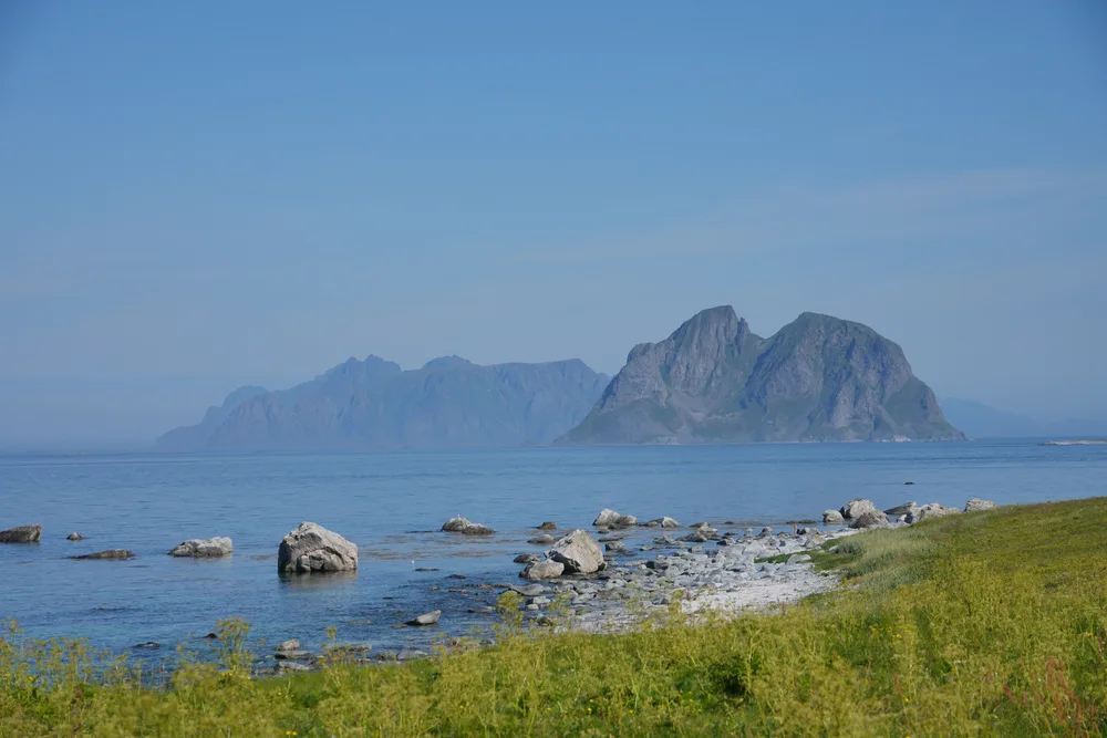
From the outer headlands at Å and Tind you are looking down the same stretch of water the 1865 traveller described, with the open sea to the west and Værøy and Røst low on the horizon in clear weather. Mosken is the small steep island out to the south-west.
Whether the water is doing anything visible depends on the tide and the wind, exactly as the old surveys say. If the wind is south-easterly or north-westerly against a running tide, you may see the roughness on the surface from shore. In calm conditions there is nothing to see at all, which is itself worth knowing before you go looking for a whirlpool.
Boat trips into the current run from Reine and from Å in the summer season and are the only way to be in it rather than beside it. They are weather-dependent, for reasons the 1897 surveyor set out clearly enough.
The current in the record
1865: a traveller arrives
Coming down to Lofotodden, the whole sea lay to the west and the Maelstrom ahead. [5]
1877: passing it
A vessel goes by the notorious Maelstrom between Lofotodden and Mosken, which was not dangerous at that time. [6]
1889: the bear and the sheep
A bear means to cross from Lofotodden to Mosken, where sheep are left out through the summer. [8]
1897: the standing seas
At a distance the current-seas appear as holms and skerries, rolling unlike ordinary waves. [4]
1907: the mechanism
Strongest between Svarvarne and Lofotodden, worst in a south-easterly or north-westerly wind. [1]
1907: the cost to the fishery
The line ground looks roomy on the chart but cannot be worked at spring tide. [12]
1911: the island and the coast
Mosken is steep and almost inaccessible, and there are only two landing places on the whole outer stretch. [7]
1912: cut off
Helle and Refsvik are often completely isolated because no boat can get round. [10]
1914: the last house
Tuv is the westernmost inhabited place on the inner side, its people living almost entirely from the sea. [9]
Ride to the end of it
from US$209Reserve now & pay later